T.D. Price1*, B.T. Grasmeijer1,2, L. Brakenhoff3, M.C.G. van Maarseveen1, H. Markies1
1 Utrecht University, The Netherlands; 2 Deltares, The Netherlands; 3 Rijkswaterstaat, The Netherlands
* Corresponding author: t.d.price@uu.nl
Introduction
On the Dutch coast, dune erosion is most common during heavy storms from the north-west, characterised by large waves and high surge levels. The volume of eroded dune sand and mode of foredune erosion following such storms has been observed to vary strongly alongshore. Although such variations have been related to alongshore-variable pre-storm (bio)geomorphology of the bar-beach-dune system, the question remains how these alongshore variabilities develop and persist over multiple storms and storm seasons. After a storm, sand slowly returns to the beach-dune system during prolonged periods of lower wave energy, until the next storm arrives. If storms follow each other up without sufficient time for the beach-dune system to recover, the effect of a single storm within such a sequence may be larger than when it occurs as an isolated storm. With this project, we aim to quantify and unravel the effect of storm sequences for the (long-term) development of the sandy bar-beach-dune system at Egmond aan Zee, using a combination of long-term monitoring and a Quick Reaction Force (QRF) to acquire measurements of dune response and the nearshore wave field during storms.
Objective and Methods
During the storm seasons (October – March) of 2017/2018 – 2023/2024 we deployed 7 pressure sensors spaced 250 m apart, along a 2 – 5 km stretch of beach south of Egmond aan Zee. All sensors were located above the high tide water level, each at different elevation levels (maximum 1 m difference). We monitored marine forecasts for approaching storms and deployed additional pressure sensors before the storm surge arrived. During the study period the sensors were submerged several times during storm surges of 1-2 m. Full bathymetric (sonar-equipped jetski) and topographic (mobile laser scanner) surveys were done at the start and end of the storm season, and additional topographic surveys of the beach and dune were performed directly before and after storms, to capture the impact of individual storms. Regular (every 2 - 4 months) topographic surveys and aerial photographs of a 6 – 10 km stretch of coast at Egmond aan Zee (Ruessink et al., 2019) provide long-term observations of the beach-dune development between storm seasons. In addition, 3 Acoustic Doppler Velocimeters (ADVs) were deployed during storm Pia, in December 2023, to acquire flow velocities.
Results
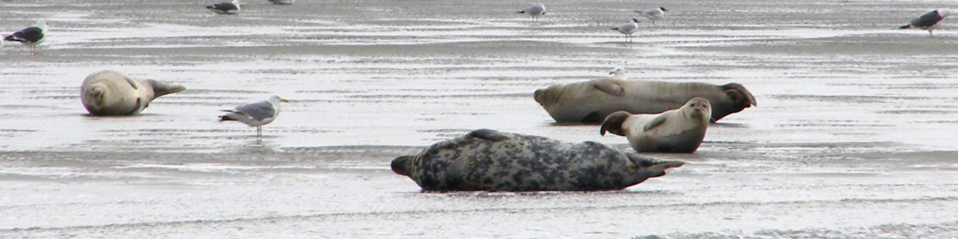
Storm activity varied from none to multiple intermediate storms during a single storm season. The bed level measurements showed a distinct alongshore variability in morphological response to storms across the entire bar-beach dune system. Dune erosion volumes and modes of foredune failure also varied alongshore, exhibiting correlations with pre-storm morphological properties, such as beach width, sandbar depths, and foredune slopes. During storm Pia (on 22 December 2023), water levels reached up to 3 m above mean sea level (NAP), corresponding to the approximate elevation of the dune toe, and offshore wave heights of 5-6 m. As a result, dune erosion varied from 1-2 m scarps at the top of the beach to rotational failures and translational slides of the entire foredune. Storm Pia was preceded by a storm with less elevated water levels 3 weeks earlier, which eroded the beach. At the meeting we will present the data collected during this set of storms, which provides valuable insight into the effect of storm sequences. Furthermore, we aim to discuss the preliminary findings, measurement strategy and future plans for our QRF activities.
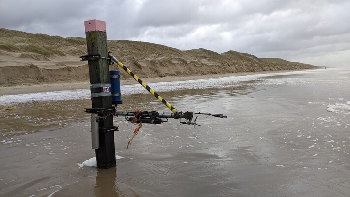
An Acoustic Doppler Velocimeter (ADV) mounted to a beach pole, with dune erosion in the background resulting from storm Pia in December 2023.
References
Ruessink, B.G.., Schwarz, C.S., Price, T.D., Donker, J.J.A., (2019), A Multi-Year Data Set of Beach-Foredune Topography and Environmental Forcing Conditions at Egmond aan Zee, The Netherlands. Data, 4, 73.
