R. Hoegen1*, T. Minns1
1 Haskoning, the Netherlands
* Corresponding author: roel.hoegen@haskoning.com
Introduction
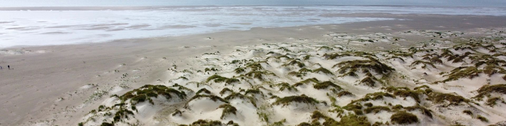
Coastal dune systems are dynamic landscapes shaped by the interplay of wind, waves, vegetation, and sediment supply. Present along most of the world’s sandy coasts, natural dune systems show great variability in height, width and vegetation. Coastal dunes are valuable ecosystems that also serve as natural flood barriers, produce drinking water, and offer recreational opportunities. Dune blowouts, local depressions formed by wind erosion, contribute to ecological diversity and geomorphic evolution of dunes. In their natural state, blowouts facilitate inland sand transport, reset successional stages, and create diverse habitats.
Historically, Dutch coastal management focused on maintaining and increasing foredune height and volume, mainly through sand nourishments and vegetation planting. While effective for flood protection, this reduced natural variability, diminished aeolian activity, and limited vertical dune growth landward of the foredune. Recently, management has shifted toward considering the entire dune system. Artificial dune blowouts are increasingly introduced as a Nature-based-Solution to restore aeolian processes, enhance biodiversity, and facilitate inland sediment transport. However, these interventions may affect the flood‑barrier function of dunes and must therefore be carefully assessed.
Objective and Methods
One location where blowouts are considered is the ‘De Zandbrommer’ project in the Natura 2000 area 'de Manteling van Walcheren' as measure to achieve habitat conservation objectives. The goal is to counteract acidification by transporting calcareous material inland through artificial blowouts. The project aims to balance ecological restoration with robust flood protection. This study assesses (1) the effect of artificial dune blowouts on dune flood safety and (2) the evolution of these blowouts under extreme conditions. To evaluate storm response, a 2D process‑based XBeach 2DH model was employed.
Bathymetry and topography are based on the most recent measurements (Rijkswaterstaat and AHN), and four artificial blowouts are implemented following the geometry of developed blowouts along the Dutch coast. This study aims to determine the minimum height that artificial dune blowouts must have in order to meet flood safety standards. The governing hydraulic conditions follow the Dutch safety regulation for this location: a 1-in-3000-year storm for 2100, with a maximum water level of 5.88 m NAP and offshore waves of 5.27 m significant height and 10.7 s period. Model results are used to assess erosion and deposition patterns, blowout evolution, and residual dune strength after extreme events.
Results
The model captures typical Dutch storm erosion and deposition patterns, with erosion of embryo dunes and the dune foot and deposition on the foreshore. The patterns differ at the blowouts, when the water and waves reach the blowouts, the steep sidewalls collapse causing widening of the blowout, while sedimentation occurs in the center. This creates a self‑protecting effect as the lowest part of the blowout increases in height during extreme conditions. Overall, erosion within the blowout area is mainly due to widening rather than lowering of the blowout.
The effect on the adjacent dunes is limited, with model runs showing almost no additional erosion outside the blowouts. This indicates that artificial blowouts locally influence the flood barrier but do not compromise the wider flood protection of the dune system. The combined effect of wind‑driven sidewall steepening during daily conditions and collapse of sidewalls during storms suggests that blowouts continually adjust their shape without indication of significant lowering of the crest level. Even under extreme scenarios, the dune system with blowouts demonstrates resilience, and blowouts do not necessarily compromise flood safety. Since many Dutch foredunes exceed required safety heights, artificial blowouts can be accommodated if carefully designed and monitored.
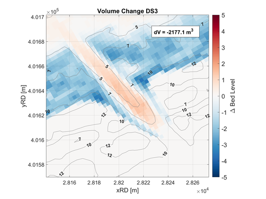
Difference plot of a dune blowout after the governing storm where red indicates sedimentation and blue indicates erosion. The contour lines indicate bed level with respect to NAP.
References
Mulder, J. P. M., Hommes, S., Horstman E. M, (2011), Implementation of coastal erosion management in the Netherlands, Ocean & Coastal Management, ELSEVIER, vol. 54, pp. 888-897.
Ruessink, B. G., Arens, S. M., Kuipers, M., Donker, J. J. A., (2018), Coastal dune dynamics in response to excavated foredune notches, Aeolian Research, ELSEVIER, vol. 31, pp. 3-21.
Ruessink, B. G., Groenendijk, D., Arens S. M., (2024), Digital Elevation Models and Orthomosaics of the Dutch Noordwest Natuurkern Foredune Restoration Project, Data, MDPI, vol. 9.
