van Rosmalen, S.J.1*, Steenvoorden, J.1, Bakhshianlamouki, E.2, Riksen, M.1, Augustijn, E.-W.3, Wijnberg, K.M.3, Limpens, J.1
1Wageningen University and Research, the Netherlands, 2Universiteit Utrecht, the Netherlands, 3University of Twente, the Netherlands
*sasja.vanrosmalen@wur.nl
Introduction
Beaches are multifunctional spaces that provide several landscape functions, space for recreation and nature development key among them. With sea levels rising and recreation intensifying, pressure for available space is growing, especially along anthropogenic sandy coasts such as in the Netherlands. As human recreation intensity constrains vegetation establishment and early dune-building1, achieving co-existence between these values is proving an increasing challenge to coastal managers. Concentrating human movement along pathways is a well known solution that enables the co-existence of recreation and nature, also on the upper beach2. Recent modelling work on the upper beach suggests the existence of regulating feedback between people following preferred routes across the beach towards shared points of interest3. Consequently, enabling the development of dunes close to pathways, further concentrating movement and fixing the pathways in place, supporting continued co-existence of seemingly contradictory landscape functions. In this study, we explore the assumed relationships between adult vegetation, dune topography, and human movement towards shared points of interest using of aerial images of footprint patterns.
Objective and Methods
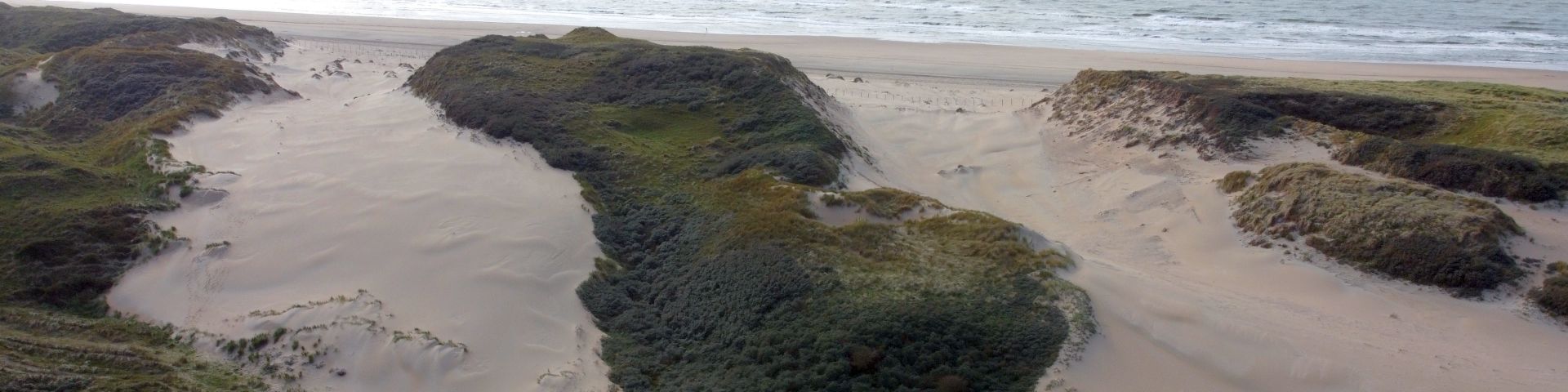
In July 2022 and August 2024, aerial images were taken at the Schelpenpad section of the Sand Engine using an unmanned aerial vehicle (Fig1a). The images were used to construct a digital surface model from which elevation and slope were obtained. From the same images, vegetation and footprints were identified by means of automated image recognition. Subsequently, the data on vegetation presence, slope and elevation were used to explain the number of footprints using a truncated negative binominal generalized linear mixed model (GLMM). Based on this model, the accumulated surface costs were calculated for the area and a least cost path analysis was performed to explore the importance of the direction of movement and points of interest.
Results
Preliminary results show that the main pathways are located in the same locations in both years. The GLMM shows that most footprints are found away from vegetation and slopes, suggesting that humans select to walk where effort is low (Fig1c). Comparing the accumulated surface cost map with the heatmap (Fig1b) of the identified footprints shows that not all low cost areas are used equally, suggesting an additional explanatory variable (Fig1). Adding points of interest to the least cost pathway analyses explained most of these discrepancies, stressing their importance in explaining the patterns in observed footprints and direction of movement. Our results suggest that combining points of interest with topography and vegetation can be used to design beach areas that enhance the coexistence of recreation and nature development.
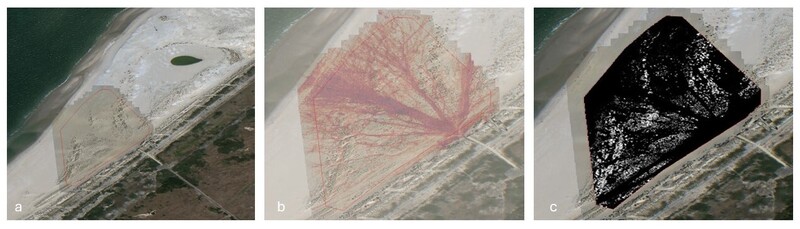
Fig 1. a) aerial overview research area, the red line delineates the research area, b) heat map of footsteps from July 2022, c) accumulated surface costs for July 2022, white high costs, black low costs.
References
1van Rosmalen, S., Homberger, JM., Riksen, M. Limpens, J. (2025). Recreation impact on the early establishment of dune-building grasses Elytrigia juncea and Ammophila arenaria on the beach. Journal of Coastal Conservation, 29, 15. https://doi.org/10.1007/s11852-025-01101-5
2van Rosmalen, S.J., Homberger, JM., Riksen, M. Limpens, J. (2025). Directing recreation pressure via pathways allows for coexistence of recreation and nature development on the upper beach. Landscape Ecology, 40, 224. https://doi.org/10.1007/s10980-025-02246-2
3Bakhshianlamouki, E., Augustijn, E.-W., Brugnach, M., Voinov, A., & Wijnberg, K. (2025). Agent-based modelling of beach visitation patterns: insights for sustainable coastal design and management. Environmental Research Communications, 7, 4. https://doi.org/10.1088/2515-7620/adc353
