M. Hendriks1,6, P. Dankers2, J. Cleveringa3, L. Sittoni4,8, P. Willemsen4,5,6,7, K. Elschot1, M. van Puijenbroek1, M.J. Baptist1
1 Wageningen Marine Research, Den Helder, Netherlands.
2 Royal HaskoningDHV, Nijmegen, Netherlands
3 Arcadis, Zwolle, Netherlands
4 Deltares, Delft, Netherlands
5 Royal Netherlands Institute for Sea Research, Yerseke, Netherlands
6 Utrecht University, Utrecht, Netherlands
7 University of Twente, Enschede, Netherlands
8 EcoShape, Dordrecht, Netherlands
Introduction
Salt marshes provide important natural habitats, mitigate effects of subsidence and sea level rise and help in coastal defence. Commissioned by the municipality of Delfzijl, the EcoShape consortium obtained the opportunity to carry out a large-scale field experiment on salt marsh construction as part of their Living Lab for MUD.
Methods
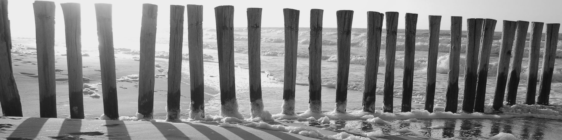
Land-water boundaries at the port of Delfzijl consist of rock protected dikes. In 2018 the bed level was raised with sand obtained from capital dredging in the estuary and a rockfill dam was built to provide shelter. The new bed height for the projected salt marshes was set around Mean High Water level from 1.65 m to 1.05 m in a gradient of 1:140. In the 15 ha salt marsh site we created test plots delineated with brushwood groynes, Fig. 1. Three plots to the west differ in shape but all have a surface area of 2.3 ha. They differ with respect to the percentage of clay and silt particles that were mixed through the top 1 m of the sandy bed resulting in 5, 20 and 50% silt. Three plots to the south have equal shapes, slopes and sizes. These plots are 1.8 ha (216 x 85 m) in size and have two openings in the groynes. They also differ in clay and silt percentage and in half of each of these plots pieces of glasswort plants (Salicornia procumbens) were seeded. A total of 13,500 glasswort plants were manually collected and cut into about 100 pieces each. The 1,350,000 plant pieces were mixed with sawdust and put in freshwater to germinate. In May 2019 in each of the 9,000 m2 test plots the pieces were seeded with a density of 50 m-2.
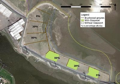
Figure 1 Aerial view of the Marconi test plots.
Monitoring
A two year monitoring programme in 2019 and 2020 will determine sedimentation-erosion rates, development of drainage channels, bed height, flooding frequency, and density & condition of the glasswort seedlings. The biogeomorphodynamic developments will be analysed with respect to heights, slopes, silt percentages, and vegetation cover. Instruments include a.o. LiDAR drone, RTK-DGPS, Sedimentation-Erosion Bars, and Acoustic Surface Elevation Dynamics (ASED) sensors. The presentation will elucidate preliminary results of the ongoing research.
Acknowledgments
This work was supported by the Dutch Waddenfonds. Cash and in-kind co-funding was received from the consortium partners of EcoShape. Abstract writing and presenting is supported by the Wageningen UR Knowledge Base programme KB-36-003-009.
I. Surname1*, F.N. Another-Surname2 , Y. Next-Surname2
1 University Name, Country; 2 Organization Name, Country
* Corresponding author: mail.name@organization.org
