P. Goessen1 *, J. Van Loon2, M.A. Prins3
1 HHNK,
2WUR,
3Vrije Universiteit Amsterdam,
Introduction
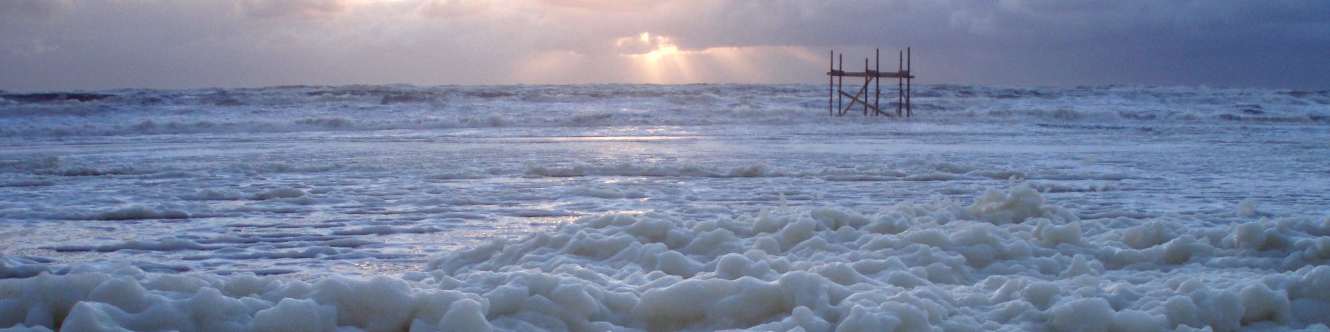
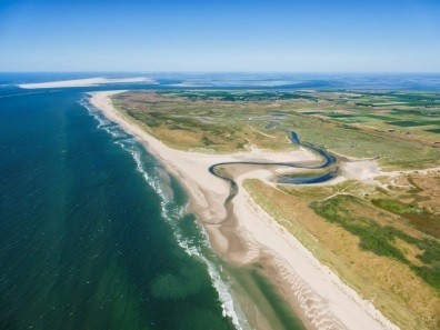
Nature reserve 'the Slufter' is a salt or brackish dune valley at the North Sea coast of Wadden island Texel. It is a sandy salt-marsh area, which inundates regularly during high tides and storm surges. It is appointed as Natura2000 area. The natural widening of the channel mouth is managed by water board HHNK to prevent potential erosion of the landward located sand dike. However, new insights in the working of the Slufter system give reason to reconsider the management of the estuary mouth and its surroundings Modelling of the processes indicates that wave reduction is less related to the width of the mouth. Ceasing dredging interventions to give more space to natural processes is therefore possible. Such changes in management of the inlet may affect the biodiversity values of the Slufter nature reserve. In strong collaboration with Staatsbosbeheer, and staff and students from VU Amsterdam, UvA, Wageningen University, Delft University, Utrecht University, and Hogeschool Van Hall-Larenstein the water board collects and analyses sedimentological, hydrological and ecological data. In these analyses we seek to understand the natural processes and to recognize indicators for change. Insight in short-term change may help to foresee long-term development under climate change. We exchange insights and knowledge with our colleagues of Zwin in Belgium.
Methods
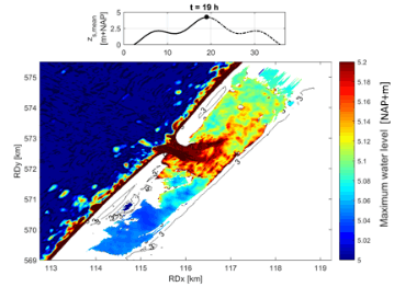
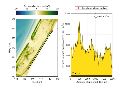
We started to collect data in 2014, and intend to proceed at least until 2024, but expect to extend until 2030. To gain insight in water safety we used Jarkus data and drone data to model the area with Xbeach and explored the impact of a shift of the mouth to a northern location and simulated several scenarios for bed level and sea level rise. Concerning sedimentology, surface samples were taken in a broad grid in 2013 and a tighter grid near the mouth in the following years. Several types of sedimentological analyses have been performed on those samples: (1) laser-diffraction particle size analysis → grain-size distribution, (2) dynamic image analysis → size-shape distribution, (3) thermo-gravimetric analysis → organic matter and carbonate content. (See also poster presentation by Prins et al). We monitored the vegetation and explored wave damping with Xbeach 1D (see presentation by Baaij et al). To gain insight in salinity, we used Dualem and monitored wells for analysing salt water intrusion to the polder.
Results
Water safety: Analyses of modelling for safety assessment give reassuring results, even with sea level rise of 2 m.
Sedimentation: see poster presentation by Prins et al
Vegetation: see presentation by Baaij et al.
Salinity: no extra inlet of salt is to be expected when the location of the mouth changes.
I. Surname1*, F.N. Another-Surname2 , Y. Next-Surname2
1 University Name, Country; 2 Organization Name, Country
* Corresponding author: mail.name@organization.org
