J. Derijckere1*, G. Strypsteen1 and P. Rauwoens1
1 Hydraulics and Geotechnics, Department of Civil Engineering, Bruges Campus, KU Leuven, Spoorwegstraat 12, 8200 Bruges, Belgium.
*corresponding author:
Introduction
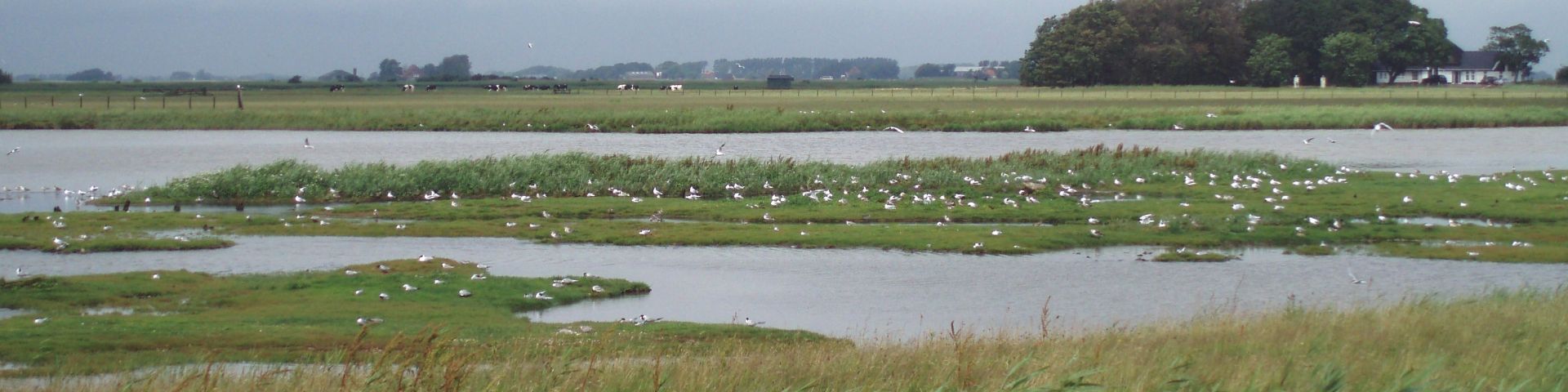
During strong wind conditions, wind-blown sand accumulates on hard engineered coastal infrastructures (e.g., dikes, roads, railways), leading to increasing costs in infrastructure management and destructive fails (e.g. train derailment) [1]. Every year, a lot of effort goes into cleaning these infrastructures especially in Raversijde, Belgium. Jersey blocks already present on the dike are able to stop a part of this wind-blown sand but are insufficient during high windspeeds. To mitigate this sand nuisance, a dune-in-front-of-a-dike pilot site was implemented on the upper beach in front of the seawall. In this study, volume changes and changes in dune parameters will be related to forcing factors (e.g., windspeed and -direction) and parameters of vegetation and brushwood fences (e.g., cover and density). In this way, the effect of brushwood fences and marram grass on initial dune development will be studied.
Methods
In the spring of 2021, a new engineered dune area of 750 x 20 m2 was constructed 10 m in front of the traditional sea dike (Figure 1). A split-plot design of 10 x 10 m2 blocks was used to plant vegetation in different spatial distributions (regular, random and clustered) with low and high densities. Occasionally, vegetation was surrounded by brushwood fences (low and high densities) at an original height of 1m. Monthly drone surveys are used to monitor topographical changes along 12 cross-shore profiles and 8 divided zones, simultaneously with wind conditions.
Results
Results show a clear difference in cross-shore development during the first year of monitoring. The influence of vegetation combined with brushwood fences is much more prominent than vegetation on itself. The combined zones had a dune growth of 18-26 m3/m while the vegetation zones captured 12-14 m3/m. These brushwood fences are able to capture a larger amount of sand but have a decrease in trapping efficiency over time as several combined zones became completely saturated at the end of the first year (March 2022). New planting will be necessary as these fences are, compared to vegetation, unable to grow and consequently trap sand in the future.
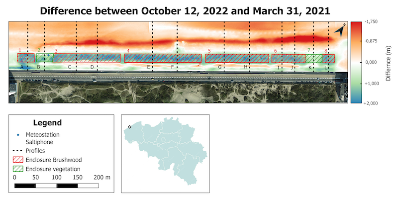
Figure 1: Dune-in-front-of-a-dike pilot site at Raversijde, Belgium divided in 8 zones and 12 cross-shore monitoring profiles.
References
[1] J. jun Cheng, F. qiang Jiang, C. xiao Xue, G. wei Xin, K. chong Li, and Y. hai Yang, "Characteristics of the disastrous wind-sand environment along railways in the Gobi area of Xinjiang, China," Atmos. Environ., vol. 102, pp. 344–354, 2015, doi: 10.1016/j.atmosenv.2014.12.018.
Acknowledgments
Thanks to Research Foundation Flanders for project funding (number: 1SE2923N)
I. Surname1*, F.N. Another-Surname2 , Y. Next-Surname2
1 University Name, Country; 2 Organization Name, Country
* Corresponding author: mail.name@organization.org
