J.R.M. Muller1*, D. Dermentzoglou2, B.W. Borsje1, A. Antonini2, J.J. van der Werf`1,3, B. Hofland2 S.J.M.H. Hulscher1
1 University of Twente; 2 Delft University of Technology; 3 Deltares
*corresponding author:
Introduction
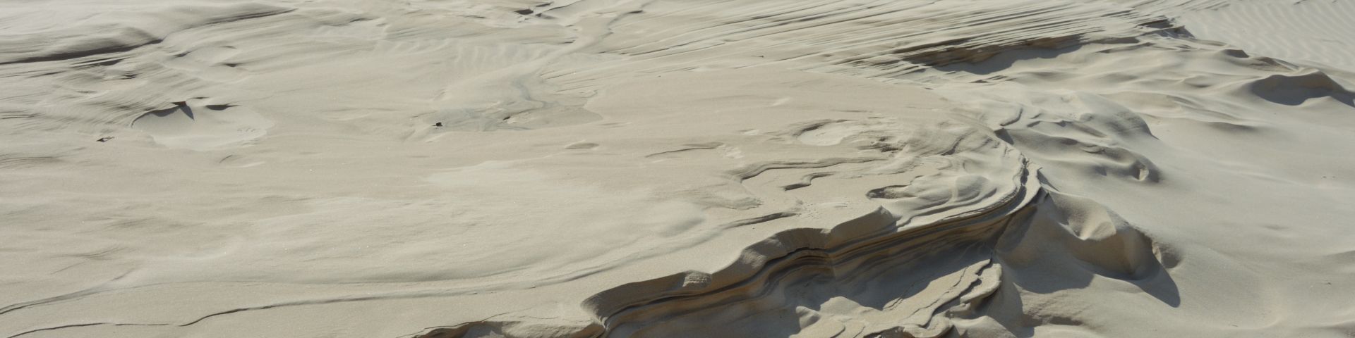
Nature-based flood defences receive increasing interest as a viable option for improving flood safety worldwide. A contemporary case is using the ability of saltmarshes to attenuate waves during storm conditions for strengthening coastal flood defences (Vuik et al., 2016). This combination of a saltmarsh with a green dike is referred to as a Living Dike. To ensure a long-term reinforcement of flood protection, it is important to understand the erosion mechanisms of saltmarshes during storms. Potential areas for erosion are at the transition between the saltmarsh and the toe of the dike and at the transition between the saltmarsh and the bare mudflat often characterized by a vertical step or cliff (Figure 1). These cliffs vary between 0.2 to 2.0 m in height, depending on soil composition and local hydrodynamics. However, wave-induced hydrodynamics governing saltmarsh erosion and dependency on saltmarsh vegetation are not clearly quantified. Furthermore, the occurrence of erosion mechanisms of a saltmarsh under storm conditions, such as mass failure events at the cliff or scour at the toe of the dike are not fully understood. As a result, existing numerical models are not able to accurately predict erosion of a saltmarsh during storm conditions.
Methods
This research aims at improving the understanding of saltmarsh erosion mechanics through a series of wave flume experiments and expand this by numerical modelling. An overview will be given of the prepared research plan. First step is to identify and quantify hydrodynamic processes governing erosion of a saltmarsh during storm conditions. For this, a 1:10 scaled wave-flume experiments will be performed. Generated waves mimicking storm conditions traverse over a 7 m long saltmarsh transect including a modelled saltmarsh meadow, a varying cliff height to a maximum of 0.2 m and dike section. Particle Image Velocimetry is used to quantify near-cliff velocities patterns in a non-intrusive way. Secondly, erosion mechanics of a real-life saltmarsh transect will be tested under storm conditions in a full-scale flume experiment. Thirdly, the unique datasets on both hydrodynamics and erosion mechanics will be used to update and validate a numerical model specifically for simulating storm event impacts. Finally, several real-life cases will be modelled and recommendations will be drawn on how to design a living dike which will be stable during design conditions.

Figure 1: Retreating saltmarsh near Wierum (north of the Netherlands) with multiple cliffs of approx. 1.2 m in total height (Photo courtesy of P. Willemsen, 2022).
References
Vuik, V., Jonkman, S. N., Borsje, B. W., and Suzuki, T. (2016). Nature-based flood protection: The efficiency of vegetated foreshores for reducing wave loads on coastal dikes. Coastal Engineering, 116:42–56.
I. Surname1*, F.N. Another-Surname2 , Y. Next-Surname2
1 University Name, Country; 2 Organization Name, Country
* Corresponding author: mail.name@organization.org
