E.W. Nota1*, L. Beyaard1 , M.G. Kleinhans1
1 Utrecht University, Netherlands
* Corresponding author: e.w.nota@uu.nl
Introduction
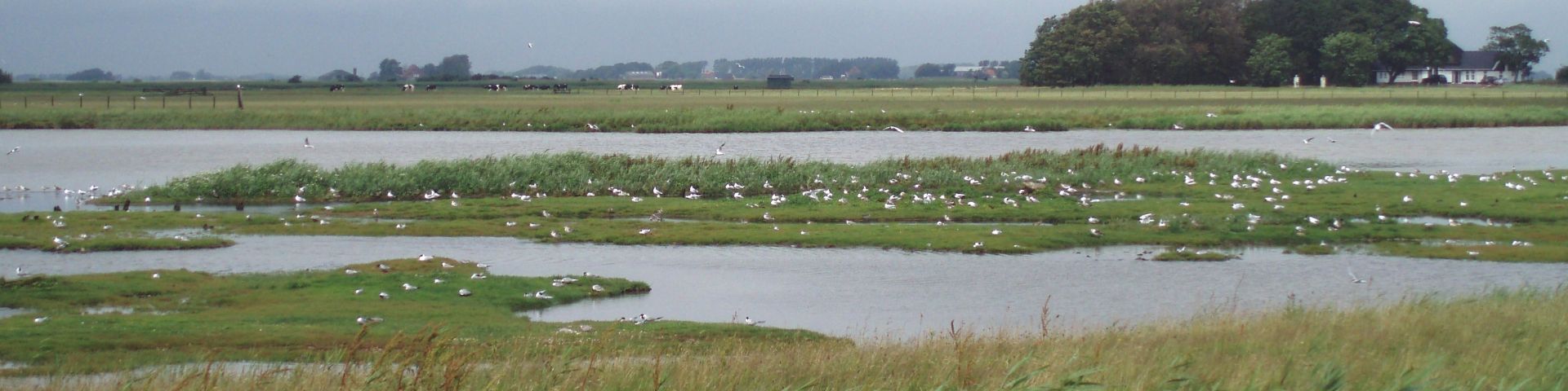
Many sandy estuaries around the world are characterized by multichannel networks and sandbars. The channels continuously shift due to tidal and river currents that drive complex sediment transport patterns and morphological change. This pose challenges to coastal safety and economically important shipping routes. Consequently, societies have interfered in many natural estuarine systems, for example with bank protection and dikes. This results in a complete or partial fixation of the estuarine planform, which affects the directions of flow and sediment transport and the space for channel migration. Alternating widening and narrowing around historic channel-bar complexes can topographically force bars, channels and scours into fixed positions (Leuven et al., 2018-a; 2018-b). Here, deep scour can be exacerbated by fixed banks, where steeper slopes can lead to shoal margin collapse, which also has consequences for bank and dike stability (van Dijk et al., 2018). This raises questions what degree of width variation causes topographic forcing, and how this affects channel scour.
Objective and Methods
Here we study the effects of fixed banks on estuarine morphodynamics by conducting scale experiments of sandy estuaries in the periodically tilting flume, the Metronome (Kleinhans et al., 2017). The 20 by 3 m Metronome is a flume that imposes tidal cycles by tilting with a period of 40 seconds, generating reversing shallow flow over a mobile sand bed, resulting in dynamic networks of channels and sandbars (Kleinhans et al. 2017). We ran up to 25.000 tidal cycles for three experimental setups of estuaries with varying planforms of fixed banks of rough industrial sandpaper, as well as a control run without fixed banks (Figure 1). At least one repeat experiment is conducted for each planform. Timelapse imagery was acquired at each tidal cycle from 7 overhead cameras and we periodically collect detailed orthophoto imagery (Figure 1) and Digital Elevation Models from a line laser scanner.
Results
For each of the studied configurations of fixed banks, we observe the emergence and persistence of topographically forced sandbars and channel scours that are consistent with repeat experiments. Forced sandbars can reach elevations above the fixed banks, whereas persistent channel scours can reach depths until the flume bottom. This is surprising for our setups with linearly converging dikes, as these planforms do not have the typical width variations that provide for constraints through which sandbars would not be able to migrate. Additionally, we distinguish quasi-periodic behaviour in the forming and disappearing of channels and sandbars that are not subject to topographic forcing. The periodicity of this behaviour is notably different between repeat experiments, implying that sediment transport in laboratory estuaries is a complex mechanism which is subject to variations in initial conditions. This could have consequences for our understanding of natural estuaries and our efforts to monitor and numerically model them.
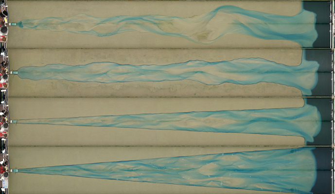
Figure 1. Orthophoto imagery of estuarine morphology in the Metronome at selected tidal cycles. The panels display the different bank configurations of the experiments conducted in this study.
References
Kleinhans, M. G., Van Der Vegt, M., Leuven, J., Braat, L., Markies, H., Simmelink, A., ... & Van Maarseveen, M. (2017). Turning the tide: Comparison of tidal flow by periodic sea level fluctuation and by periodic bed tilting in scaled landscape experiments of estuaries. Earth Surface Dynamics, 5(4), 731-756.
Leuven, J. R., Braat, L., van Dijk, W. M., de Haas, T., Van Onselen, E. P., Ruessink, B. G., & Kleinhans, M. G. (2018-a). Growing forced bars determine nonideal estuary planform. Journal of Geophysical Research: Earth Surface, 123(11), 2971-2992.
Leuven, J. R. F. W., De Haas, T., Braat, L., & Kleinhans, M. G. (2018-b). Topographic forcing of tidal sandbar patterns for irregular estuary planforms. Earth Surface Processes and Landforms, 43(1), 172-186.
Van Dijk, W. M., Mastbergen, D. R., van den Ham, G. A., Leuven, J. R., & Kleinhans, M. G. (2018). Location and probability of shoal margin collapses in a sandy estuary. Earth Surface Processes and Landforms, 43(11), 2342-2357.
