E. Kragiopoulou1, A. Pieterse1*, B. Verheyen1, A. Bolle1
1 IMDC nv, Antwerp, Belgium. *
Introduction
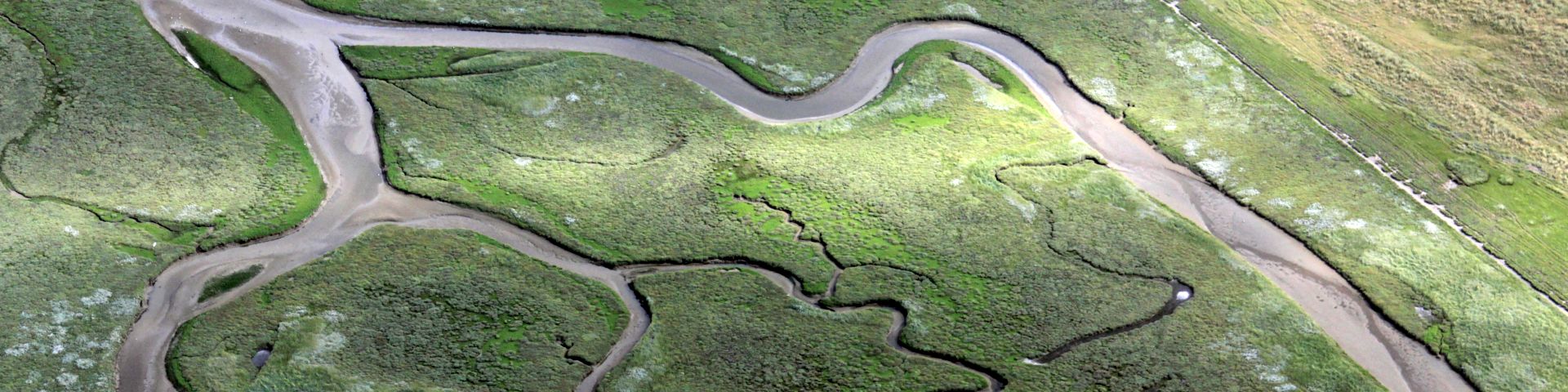
Coastal protection programs are now turning more and more towards 'building with nature' solutions, rather than engineering defences, which are often costly and unsustainable in the long run. Also in the context of the 'Complex Project Kustvisie', a project that aims at defining a long term vision for the Belgian coastal protection strategy, several soft, sandy coastal defence measures are being considered. This makes it imperative to gain more insight in the potential evolution of these sandy measures. Aeolian transport plays an important role in the evolution of sandy coasts, especially in dune areas. Approximately half of the Belgian coast consists of sandy beaches combined with dunes (Figure 1). Wind-driven transport is crucial for the natural growth and recovery of dunes between storms and is an important mechanism for a natural, dynamic coastal protection. On the other hand, in areas with towns and dikes, aeolian transport can have a negative economic impact due to the deposition of sand on roads (Strypsteen et al., 2017). Understanding aeolian transport processes in coastal areas, and estimating yearly aeolian transport quantities along the Belgian coast is thus essential.
Approach
To support the design of sandy coastal defence strategies, the use of modelling aeolian processes at the Belgian coast was explored. Aeolian sand transport was estimated using Duna, a 1D profile model (Roelvink and Costas, 2019), which can be applied either as a stand-alone model, or as a module combined with XBeach. Duna is a process-based morphodynamic model that considers wind, sediment, vegetation, and various other components. The wind model combines effects of topography on the distribution of wind shear stress, of wind direction and sheltering, and of vegetation and moisture. The sediment transport model in Duna is based on a Bagnold model, and includes armouring effects. In addition, vegetation cover and height, grain size, slope, and moisture content are taken into account.
Results
Duna was applied to representative profiles of the current situation at the Belgian coast, as well as profiles including potential future nourishment measures. In addition, the numerical modelling results were compared to results from field measurements at the Belgian coast. The highest aeolian transport rates were found for wind directions perpendicular to the coast. In cases where vegetation was present on the high beach, a decrease in wind speed due to the presence of vegetation was clearly visible. In several cases, the aeolian sediment transport peaked at the dune foot, where the slope of the profile sharply increased (Figure 1). Initial estimates of yearly aeolian sediment transport rates were on the same order of magnitude as those previously found in campaigns along the Dutch and Belgian coast.
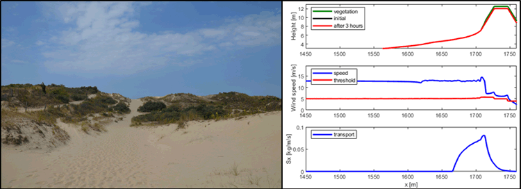
Figure 1 (left) Dune area at De Panne in the west of the Belgian coast. (right) Model simulation for a 3h wind event, with profile (top), wind speed (middle), and aeolian sand transport (bottom).
References
Roelvink D. & Costas S. (2019). Coupling nearshore and aeolian processes: XBeach and duna process-based models. Environ. Model. Softw., 115, 98–112, doi: 10.1016/j.envsoft.2019.02.010.
Strypsteen G., Montreuil A.-L. & Rauwoens P. (2017). Aeolian sand transport at the belgian coast: Field campaigns and first results. Coastal Dynamics 2017, Helsingør, Denmark.
I. Surname1*, F.N. Another-Surname2 , Y. Next-Surname2
1 University Name, Country; 2 Organization Name, Country
* Corresponding author: mail.name@organization.org
