
A. Valsamidou1,2,*, D. van der Wal1,4, M. Rietkerk2, G.K. Keller2, T.L. Mc Donell2, M.G. Kleinhans2, J. van de Koppel1,3
1 Royal Netherlands Institute for Sea Research; 2 Utrecht University; 3 University of Groningen; 4 University of Twente
*corresponding author:
Introduction
Coastal peatlands are dynamic ecosystems subject to complex environmental and anthropogenic controls. Observations from the past (Holocene southwestern Netherlands), where peatlands expanded seaward following sea-level rise, make them relevant to current and possible future conditions and raise the question as how they can adapt and develop under such pressures. Their development scheme includes different spatial and temporal scales, as well as non-random pattern formations along them, determined by biogeomorphic and hydrological controls. The aim is to assess if the formations and processes of the different scales affect the resilience of coastal peatlands, if these patterns can be used as indicators for the ecosystem state, and if there are more than one stable ecosystem states where after a threshold of condition changes there is an ecosystem shift, i.e., peatland-to-saltmarsh.
Methods
First, a large-scale numerical model including revisited concepts of the ridges-pools surface patterns model (Eppinga, M.B. et al., 2009) and the bog-growth model (Clymo, R. S., 1984) will be implemented within an HPC context, to simulate the development of large-scale patterned domes and depressions in time. It's spatial and temporal size requires that the computations will be carried out on graphical processing units (GPUs). We will then study the development of a complex landscape of small-scale patterning embedded within a large-scale fen-bog complex, and its resilience to SLR. Finally, the model results will be compared to real-world ecosystems using remote sensing data and field data acquired from relevant locations.
Results
The expected results of the project will include (i) the numerical model simulations, (ii) field and remote-sensing data to validate them and (iii) visualizations of the numerical model results to enhance communication with the public.
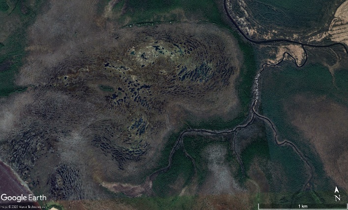
Figure 1: Close-up to the patterned peatlands in Arkhangelsk estuary, Russia [© Google Earth].
References
Eppinga, M.B., Rietkerk, M., Wassen, M.J. et al. Linking habitat modification to catastrophic shifts and vegetation patterns in bogs. Plant Ecol 200, 53–68 (2009). https://doi.org/10.1007/s11258-007-9309-6
Clymo, R. S., 1984. The limits to peat bog growth. Philosophical Transaction of the Royal Society of London, pp. 605-654. https://doi.org/10.1098/rstb.1984.0002
I. Surname1*, F.N. Another-Surname2 , Y. Next-Surname2
1 University Name, Country; 2 Organization Name, Country
* Corresponding author: mail.name@organization.org
